

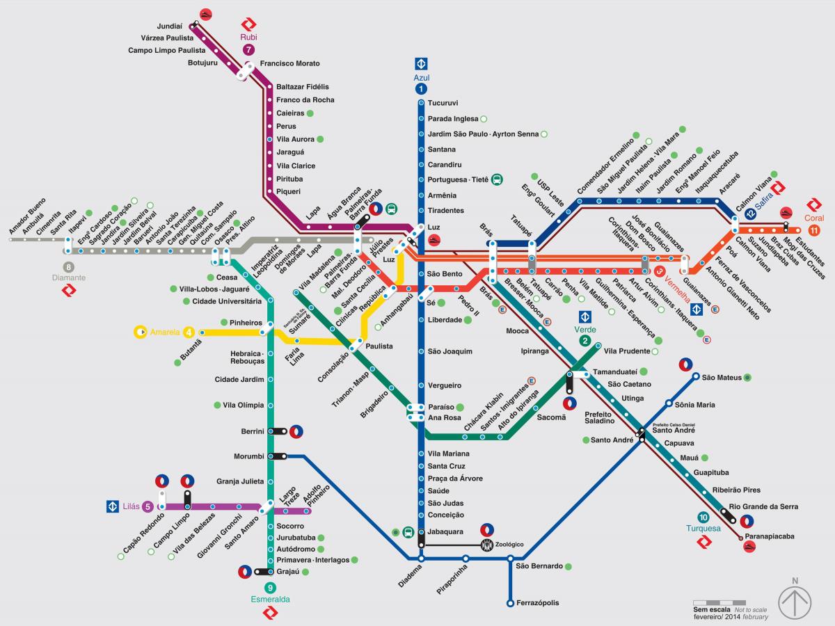
You can find on this page the São Paulo metro map to print and to download in PDF. The São Paulo metro map presents the network, zones, stations and different lines of the metro of São Paulo in Brazil.
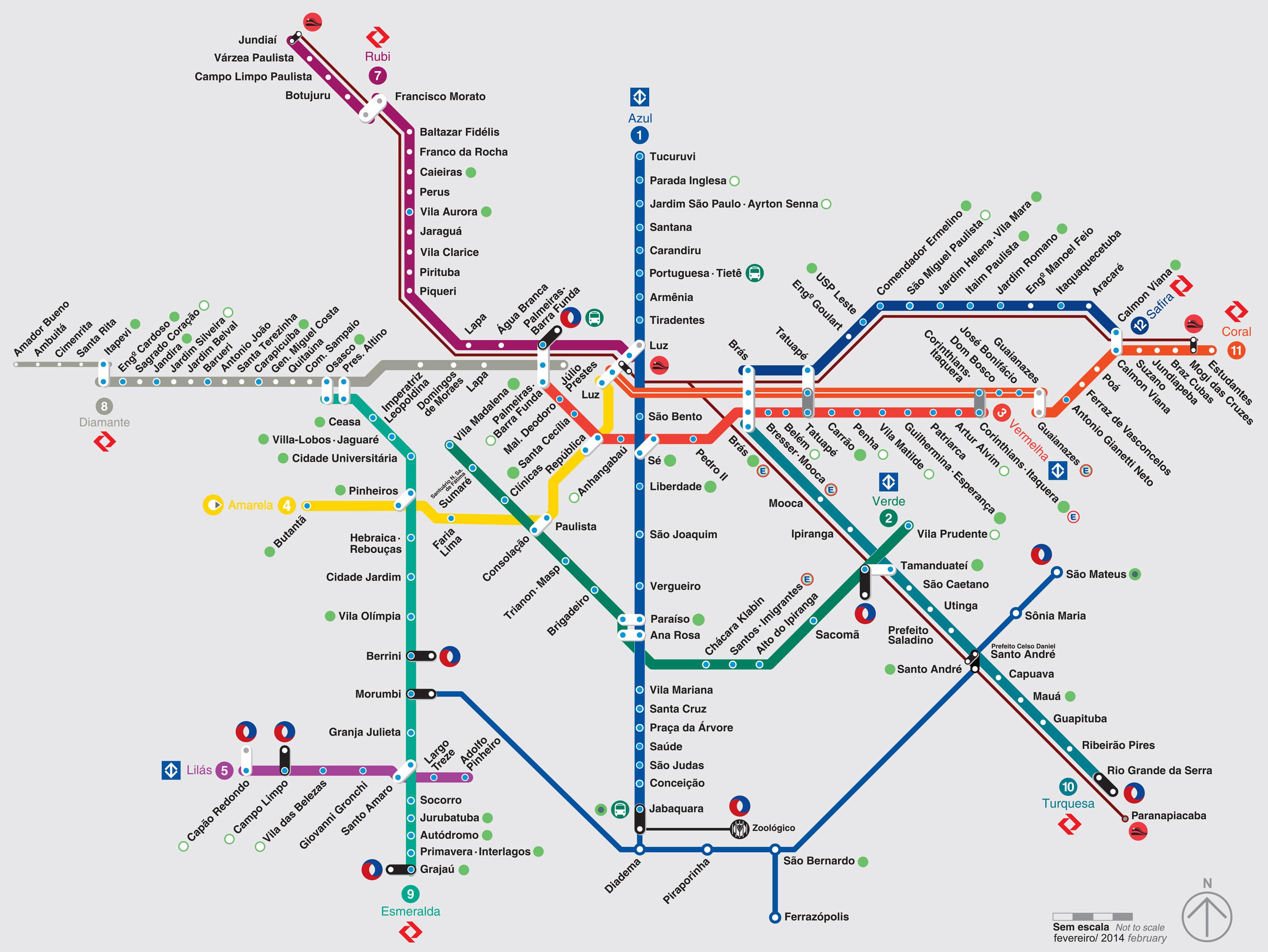
The São Paulo metro map shows all the stations and lines of the São Paulo metro. This metro map of São Paulo will allow you to easily plan your routes in the metro of São Paulo in Brazil. The São Paulo metro map is downloadable in PDF, printable and free.
São Paulo subways which transport 877 million passengers per year, exist since 1974 and are operated by the Companhia do Metropolitano de São Paulo and ViaQuatro. Its network includes the following 5 lines: * Line 1 (Azul): Tucuruvi ↔ Jabaquara * Line 2 (Verde): Vila Madalena ↔ Vila Prudente * Line 3 (Vermelha): Palmeiras - Barra Funda ↔ Corinthians – Itaquera * Line 4 (Amarela): Luz ↔ Vila Sônia * Line 5 (Lilás): Capão Redondo ↔ Largo Treze
The São Paulo Metro is the metro that serves São Paulo, Brazil. The São Paulo Metro is part of the metropolitan rail transport system, along with the CPTM (train). Inaugurated in 1974, it is historically the first metro in Brazil. The São Paulo Metro is also by its dimension the largest in Brazil. Each line is represented by a color: * Line 1 - Blue, * Line 2 - Green, * Line 3 - Red, * Line 4 - Yellow, * Line 5 - Lilac and * Line 15 - Silver.
The São Paulo metro is convenient, safe, fast and clean. It is modern, safe and very busy. Be careful however at rush hours and remember to keep your backpacks in front of you due to pickpockets. Two main lines are indicated for tourists: the linha azul (north-south), and the linha verde. They intersect at the Paraiso station. A third line is still interesting for visitors, the yellow one, which passes through Luz, Republica, Consolação, Pinheiros and goes to Butantã Park.