

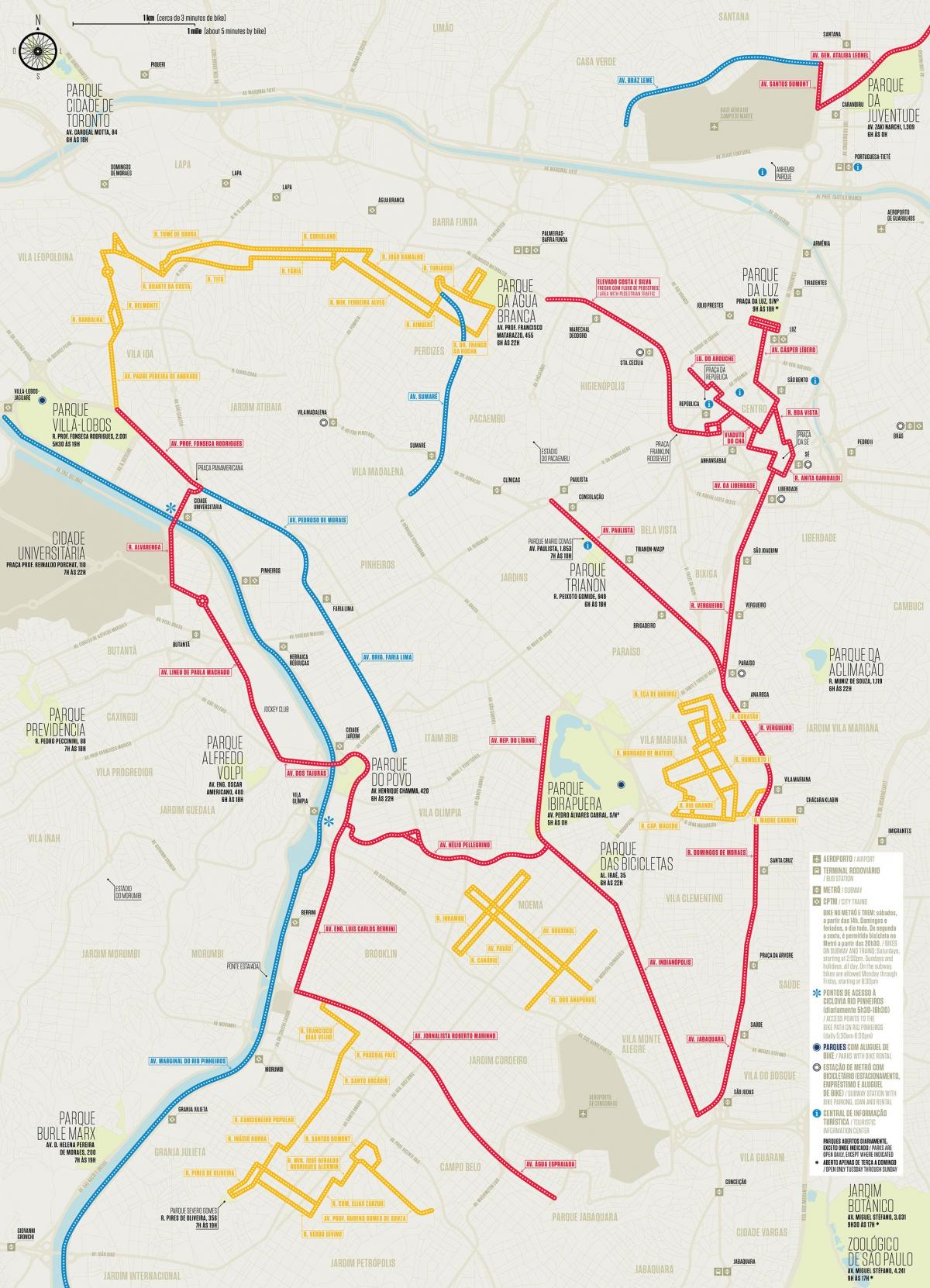
You can find on this page the São Paulo bike map to print and to download in PDF. The São Paulo bicycle map presents the bike routes and lanes of São Paulo in Brazil.
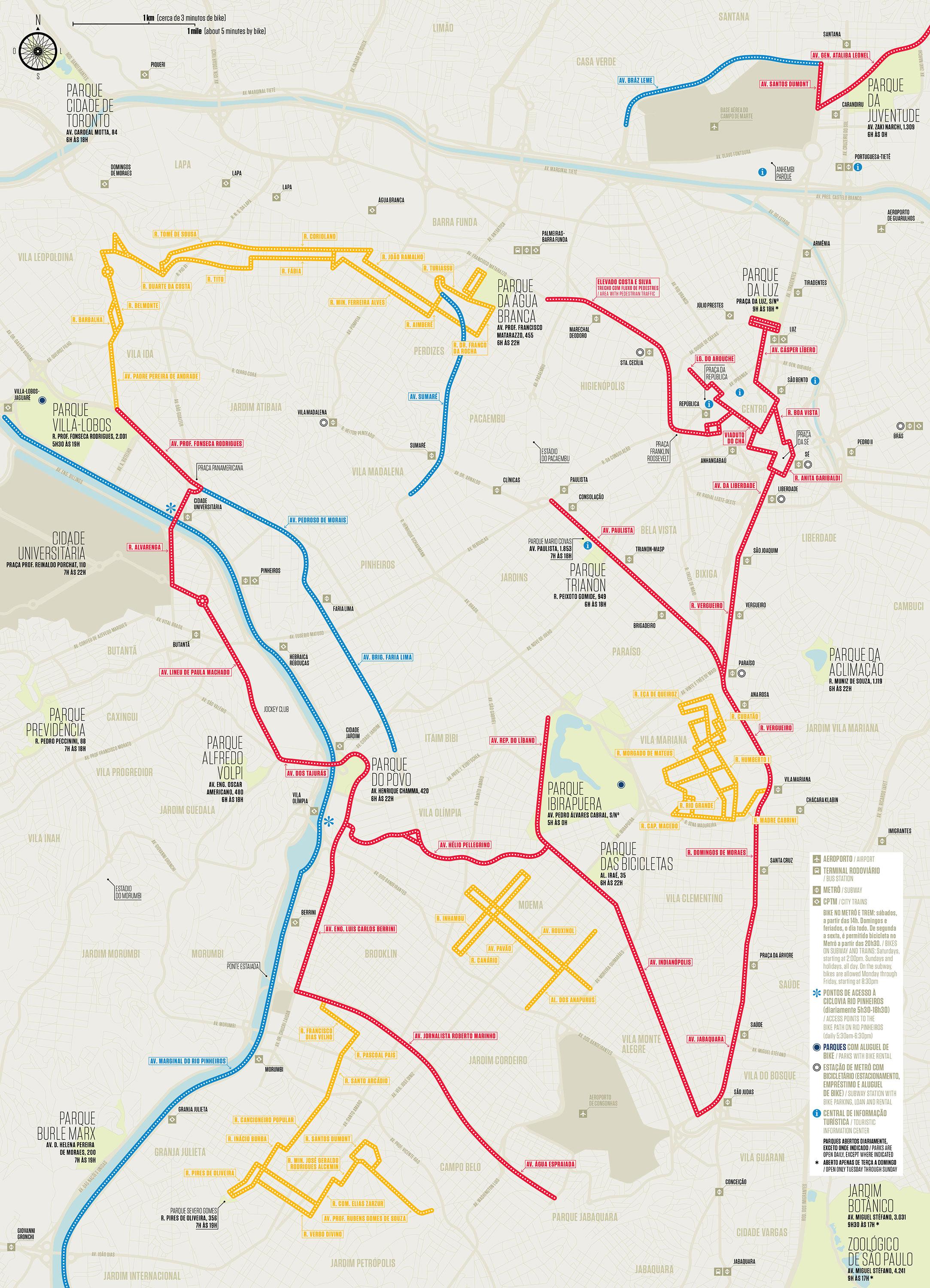
The São Paulo bike lane map shows all the bike routes of São Paulo. This bicycles lanes map of São Paulo will allow you to easily plan your routes with a bike in São Paulo in Brazil. The São Paulo bike lanes map is downloadable in PDF, printable and free.
The number of kilometres of cycle tracks and bicycle paths is increasing in São Paulo. The São Paulo bike network is about 74 miles (120 km) thanks to a strong policy to develop the dedicated cycle path initiated by the city of São Paulo. Many dedicated lanes for cyclists have been built to facilitate coexistence with motorists.Bike routes were created to help people enjoy the city.
Sao Paulo is constantly experiencing traffic jams, which is why large communication campaigns appear on the benefits of cycling. Bicycle lanes are laid out along the main arteries, identifiable by the drawing of a white bicycle on the ground. Red cycle paths, completely separated from the road, with numerous bridges to cross the motorways, have been created.
Free bicycle rides are offered for bike tours of the city centre, cultural sites, the walls, Ibirapuera Park. On weekends and holidays the Paulista is reserved for bicycles, as are several major roads and parks such as Parque Ibirapuera. Self-service bicycles have appeared such as Yellow Bike in the center of Sao Paulo. Yellow Bike announces 2000 bikes and 1000 scooters.